Here’s something to show that I’m not working all the time.
In the last month, as Charleston, SC, artist, Bob Graham would say – I’ve gotten back on my horse. That’s an inside Facebook joke.
Here at Bonneau Beach, SC, the headquarters of Shoestring Publishing Company, we live in what some people might think of as paradise. We live at the edge of Lake Moultrie and the Francis Marion National Forest – both man made in the mid 1930s by a government trying to pull Americans out of a depression.
The lake was built to provide hydroelectricity for rural Berkeley County and the forest was planted to recover land overworked by cotton plantations. Both projects created jobs for men where there were no jobs. Both projects still provide jobs, recreational opportunities, and a good chunk of undeveloped land. There’s a lesson there missed by today’s politicians, but we’re not going into that today.
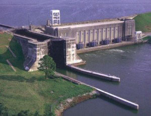
Here’s a photo of the old hydro dam (Jefferies Generating Station) and the Pinopolis Lock which can move boats from the lake down to the level of the Tail Race Canal, which then runs into the Cooper River going down to Charleston. The area of Lake Moultrie and the Tail Race Canal in Moncks Corner is in the same area of America’s first summit canal, the Santee Canal, which began operating in 1800 moving crops from inland plantations to Charleston.
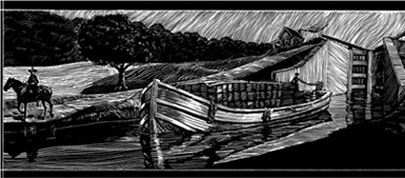
Here’s a drawing of the old canal
OK that’s your short history lesson of this area.
Over ten years ago I use to ride my single gear bike around my neighborhood on a route that took me ten miles. Eventually I discovered I could ride the length of the dike, holding back part of Lake Moultrie from our neighborhood over to Overton, another community on the lake toward Moncks Corner, SC, giving me a more interesting ten mile ride. The distance from our end of this part of the dike is about five miles to Overton. I was doing this ride almost every day when it wasn’t raining, too windy, too cold or too hot.
For some reason about a month ago I had decided to give our cars their once a year bath. During the process I got a look at my old bike stashed under the carport. The tires were both flat and it was covered in dust and cobwebs. After I finished the cars I got the bike out and pumped up the tires – they still held air – and cleaned it up and oiled the chain and gear. It didn’t look too bad – worn but still respectable.
The next morning I took it for a test drive and made it through a third of my old route. Man, when I got off that bike my legs were rubber and burning. It’s been awhile since I was knocking out those ten mile rides and I wasn’t 60 years old back then either.
It took about two weeks to get up to doing two-thirds of the route, but I was getting into the swing and getting used to the routine. One Saturday morning as I was making my first leg around my route and coming up to the spot where the dike begins – for some reason I went up that entry road to the entrance.
After 911, Santee Cooper, the power utility which manages the lake, got money from Homeland Security to build gates on the dike to prevent terrorists from driving a truck up on the dike and blowing it up or pouring poison into the lake. Oh, I guess I didn’t mention that the dike is wide enough to drive on and Santee Cooper’s security drives it everyday. Eventually they put a pedestrian gate in the fence as people who used to walk the dike for exercise complained and a bike can fit through it.
Funny thing, there are a number of lake access roads in our neighborhood that lead right down to the lake so anyone, any time of the day could ride into the lake and dump a truck load of poison into it. Of course those terrorists would be at great risk – after all this is Berkeley County and almost every household has an arsenal of guns on hand and every stranger has a hundred eyes on them when they enter the area.
So, I’m up on the dike – there’s a little breeze and it’s a wonderful morning. I’ll check it out a bit. I had been thinking about my old days of riding on the dike. By the time I hit one of the turns in the dike I realize I had gotten myself into something I hadn’t planned on and as stubborn as I am – I’m about to do something pretty stupid – I keep going.
By the time I make it to the other end of the dike where Overton begins, my butt is killing me and I’ve got to go all the way back. I’ve already gone over six miles and it’s at least six miles back to the house. The sun is a lot higher in the sky and it’s getting hotter, I don’t have any water, I forgot my sunglasses and had the wrong hat on. I had my cell phone with me, but there is not a lot of coverage in that area. It was all coming back to me how I used to do these bike rides – I was prepared. And, I’m 60 now.
What really hit me smack in the face is the reality and memory of why I didn’t ride the dike when there was a breeze. When the breeze is at your back on the first leg of the trip – it’s in your face all the way back.
Now, don’t think that this experience wasn’t a wonderful event. I was out in nature and seeing all kinds of animals – mostly birds on this ride. There were wild turkeys, egrets, great blue herons, osprey, woodpeckers, Canadian geese, plenty of turkey vultures, cormorants, all kinds of small common birds – a bald eagle and pelicans – yes, pelicans on the lake. Of course there are plenty of turtles, dragon flies, and bull frogs in the ponds behind the dike. I hadn’t seen any gators or snakes yet, but I know they are there.
I still remember the day I was on the dike and came across a dead ten foot gator that a boat must have hit and killed. It had washed up on the rocks of the dike. The head and teeth were huge. I’ve looked at the lake totally different since that day.
Anyway, on the ride back I was up against that great breeze I enjoyed earlier, luckily to my side most of the way but in my face for the last mile and a half. Near the end the dragon flies were flying along side me as were the turkey vultures – they could smell – old man down. At one point two pelicans passed me floating in the air – heading in the same direction. I had this feeling of – look behind you – and when I did, there was a third one just above my head, just a little to my rear and on the left. I hit the brakes and stood there thinking – Hey guys, I’m not that old yet. My story is not over.
When I finally made it home – talk about rubber legs and I couldn’t sit very well the rest of the day. But I recovered.
So this Saturday, a week later, I was more prepared and I took my camera and all necessary items. So here’s a little photo journey of a bike ride on the dike. It was a little earlier, so there was some mist or fog, no wind, and I went directly to the dike to start off.
Because of the mist I had to wait until I was about four and a half miles into the ride before I could take my first photo.
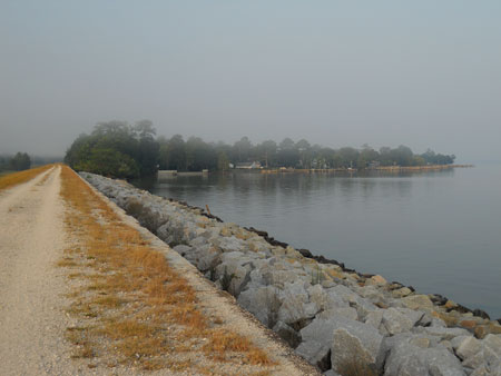
This is a shot of the Overton neighborhood on the other end of this part of the dike.
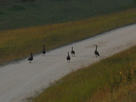
This was a group of Canadian Geese getting ready for their morning swim. They were coming from the National Forest side of the dike to a little beach at the Overton end.
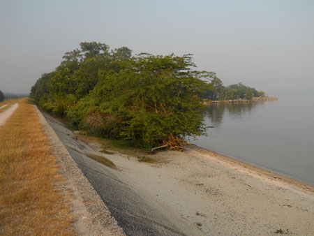
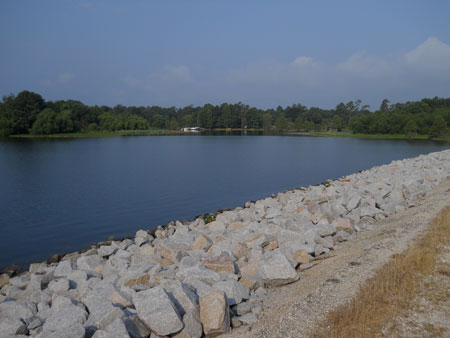
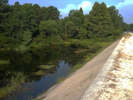
Here’s a shot of that beach. Santee Cooper has not filled this in with rocks to re-enforce the dike – I guess to give folks on this side a little beach area.
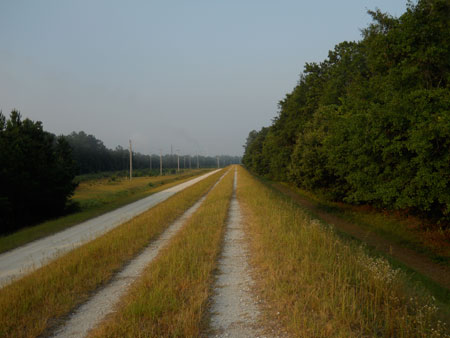

This part of the dike runs behind the neighborhood. I continued to ride the dike behind Overton till the end. The gate for people to pass through was 20 feet down the side of the dike to the left on another access road, so this was the end for me today.

Here’s a shot off in the distance at the smoke stacks of the Jefferies Generating Station. Santee Cooper now burns coal there – the hydro days are over. But, it’s a museum now.
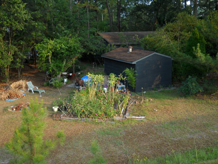
On the way back, here’s a shot at a backyard garden area of one of the residences in Overton.
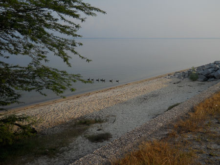
When I got back to that little beach I could see that the geese were swimming back to the beach so I got off the bike to see if I could sneak a picture.
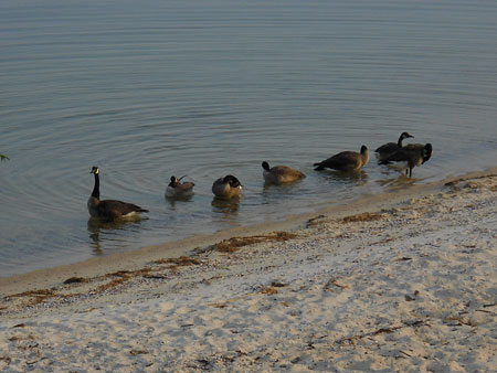
Here they all are.
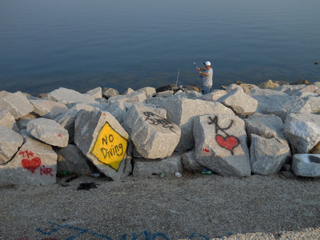
Here’s a shot at one of the public access parts of the dike. On Hwy. 52 which runs parallel to the dike for a while there is a picnic area, called the Canal, part of Francis Marion National Forest, where you can park and walk to the dike. And, where the general public has access to mother nature – some elements of that public always has to leave a sign of them being there.
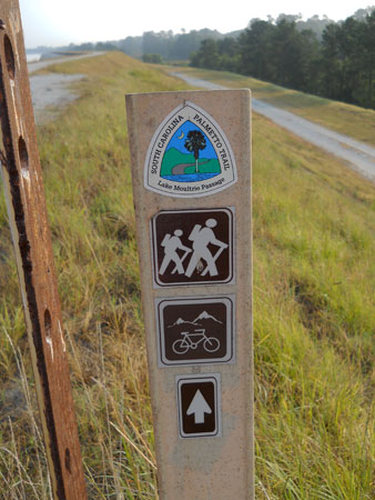
This is also where the Palmetto Trail comes onto the dike.
The Palmetto Trail (not completely finished) runs from Awendaw, SC, on the Atlantic Ocean all the way up to where South Carolina shares a border with Western North Carolina at Oconee State Park – a 425 + mile trail. A small portion of it runs atop the dike on the northern end of Lake Moultrie. This part of the trail is mostly through the Franics Marion National Forest and around Lake Moultrie and Lake Marion.
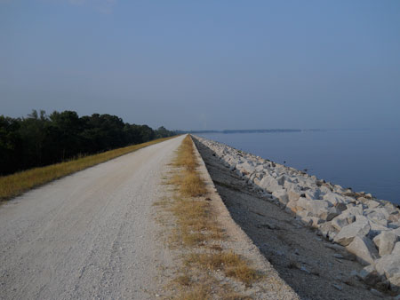
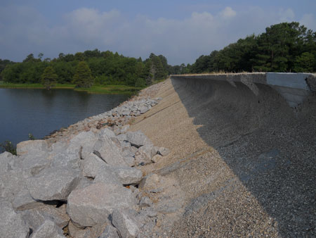
Here’s a view of the back side of the dike. It should be noted that you can’t hear cars on Hwy. 52 passing by, but you will hear trains passing by on the CSX tracks that run between the lake and Hwy. 52. Those tracks run north to south. We see and hear Florida orange trains, coal trains, freight trains, and Amtrack – going by all day and night. When it’s quiet you can hear the trains blow their horns three miles away, but most of the time I just don’t hear it anymore after years of hearing them.

You can’t see it very well, but there is a bald eagle with something it caught and then came to eat it on top of this utility pole. I’m using a pocket camera which isn’t too bad, but it’s not like a real camera with a real telephoto lens. You have to look close, but it’s there. We see and hear eagles all the time in our neighborhood. The pelicans are the unusual sight around here these days.
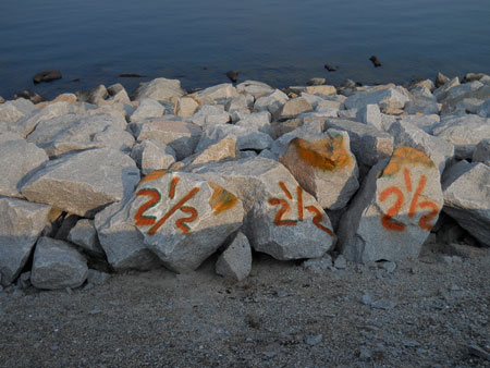
Here is the two and a half mile marker. Someone has put half mile markers down for walkers I guess.

Here’s a shot looking back toward the way back home – well before several turns of the dike.
Here’s a shot looking back toward Overton.
Here is a shot at what I call big bird poop – full of seeds.

Here’s a shot at the results of big bird poop. Birds are great pollinators. They eat the fruit off of plants and bushes and the next thing you know, you have plants and bushes growing in the rocks – growing everywhere.

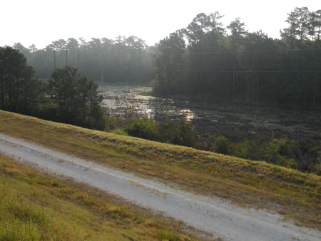
Here’s a shot at the intake of water from the lake for the Rembert C. Dennis Fish Hatchery located between Bonneau and Bonneau Beach. They raise a lot of the fish to restock the lake – which now has two dams on the rivers flowing out of the lake to the ocean. There’s a fish lift on the dam at the Santee River.

Here’s the intake pipe.
Here’s looking down the backside of the dike to the hatchery.
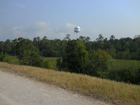
Here’s the last turn of the dike. You can see the Bonneau water tower in the background. Lake Moultrie now provides good drinking water for the region – thanks to Homeland Security – keeping those terrorist out of our lake.

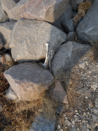
Here’s a couple of view of a little protected cove near the entrance to the dike on our side. At this point I spotted something down in the rocks I want to get a closer look at. So, I get off the bike and jump down off the road level of the dike.
Here’s a view from down in the rocks.
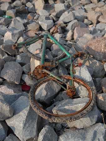
Here’s a sign of a former dike bike rider. I guess they didn’t make it home one day.
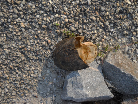
I am never surprised at what I find in these rocks along the dike. Anything that can fall out of a boat, be tossed out of a boat, or blow into the water from someone’s backyard – you’ll find washed up on the rocks, not to mention all the junk the fishermen leave there. And, mother nature contributes too.
You’ll find dead fish, dead animals, dead animal parts, animal bones (turkey vultures) and parts of trees. What’s amazing is when you find a huge tree trunk that must weigh tons – washed all the way up to the top of the rocks. That shows how strong the storms are on the lake with such a shallow bottom.
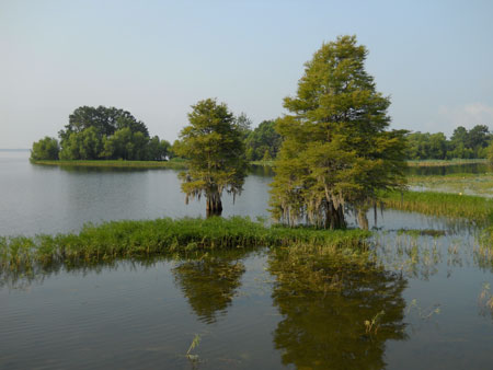
Here’s a closer shot of that little cove – closer to water level.
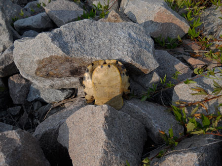
Here’s the turtle shell I spotted from the top of the dike. A boat must of hit it and cracked its shell in half and then it eventually washed up on the rocks where – as Rudy Mancke, of ETV’s NatureScene says, birds turned turtle into bird. If it had been whole I would have taken it home as a real prize.
This last shot is looking toward the end of my ride on the dike.
It turned out to be a two and a half hour ride. It takes a lot longer when you’re stopping and taking pictures – especially if you’re going to climb down off the top of the dike into the rocks. And, it took a lot longer now that I’m 60 – but, my legs were less rubbery this time, but my butt was still sore. TMI – sorry.
That’s an adventure here in what some people call paradise. We’ll get back to the visual arts – real soon.
P.S. – I received an e-mail from Willard Strong of Santee Cooper Corporate Communications clearing up and correcting a few things I wrote in my blog entry – some based on “myth” I guess. I want to make these folks happy as they provide my electricity and I like my air conditioning.
Here’s what he offered: First, “the hydro days are over” is not accurate. Santee Cooper’s hydroelectric operations (and Pinopolis Lock operations) have been going on continuously since Feb. 17, 1942, when the first unit at the Pinopolis Power Plant (renamed Jefferies Hydroelectric Station in 1944 for Sen. and Gov. Richard M. Jefferies). The five units at Jefferies Hydro (totaling 128 megawatts of generating capability) are still in service. Also, there is not a “museum” at the hydro plant, although there are old pictures on the wall of a room there. Tours are available. (Side note: There is the Berkeley County Museum and Heritage Center inside the gates of the Old Santee Canal Park, formerly the Old Santee Canal State Park, Santee Cooper assumed operation of the park over a decade ago).
Also, the “fish lift” you refer to is on the Rediversion Canal (not the Santee River) at the St. Stephen Powerhouse, constructed and owned by the U.S. Army Corps of Engineers and completed in 1983. As you may know, this is called the “Cooper River Rediversion Project,” although the Cooper River was never really diverted as the Santee River was, the Cooper’s flow was altered by Rediversion, as it was by the original diversion of the Santee River. This 14-mile long canal between Lake Moultrie and the Santee River is technically not part of the original Santee Cooper Hydroelectric and Navigation Project (constructed from April 1939 to December 1942), and is not part of Santee Cooper’s federal license to conduct hydroelectric operations. However, it is now an integral part of this fairly complex lake system. There are three hydro units at the St. Stephen Powerhouse and Santee Cooper receives the 84 megawatts it is capable of producing and Santee Cooper actually controls it remotely (turning it on and off when needed or when there is enough water to run it) from our energy control center at the Moncks Corner headquarters.
You, as a publisher, please indulge me on two style notes: We officially use “Tailrace Canal” (I know the S.C. DOT made signs on the bridge with two words and “Tail Race Plaza”). “Tailrace” is actually a generic word in dictionaries. The other is “Canada geese,” sounds awkward to say, but my trusty AP Stylebook says that’s the way to do it. If you’re interested in more history about us, we have “Powering Generations, History of Santee Cooper 1934-2009,” released last year and published by The R.L. Bryan Co. in Columbia. The book is available for purchase at the Berkeley County Museum. I am the museum’s board chairman. It’s only $25, a bargain by hardbound prices of today. Hope this helps you understand more about us. If you have more questions, I’d be happy to assist you.
Best regards,
Willard Strong
Santee Cooper Corporate Communications
Corporate Headquarters
1 Riverwood Drive
Moncks Corner, South Carolina 29461
843-761-4053